Golden Gate Canal Vegetation Removal Project
The Big Cypress Basin manages a network of 123 miles of primary canals, 31 water control structures and three back pumps providing flood control during the wet season and protecting regional water supplies and environmental resources from over-drainage during the dry season. The Basin includes Collier County and part of Monroe County. One of the Basin’s missions is to protect homes and businesses from flooding, and one of the ways we accomplish that mission is to remove vegetation, trees, debris, and other items that could cause blockage of canals and structures which increases the risk of flooding after a storm or hurricane. The Golden Gate canal has been identified as one of the priority canals for flood control.
The work will begin in March 2026 and will be based in the water. Temporary staging areas will be set-up for the vegetation at the end of some roadways in this project area.
All impacted residents will be notified in January 2026 and again two weeks prior to the commencement of work in a specific area. This webpage will be updated regularly with any canal closures, property access details and project status updates as needed.
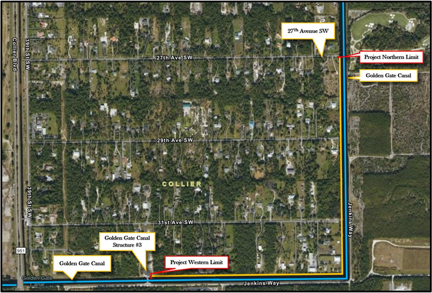
The map of the project area is below.
Golden Gate Vegetation Project Map
For More Information
- Big Cypress Basin
- Flood Control
- CONTACT:
Lisa Koehler, BCB Administrator
Email: lkoehler@sfwmd.gov
Call: 239.263.7615 ext. 0
Cell: 239-289-4405