New Measuring Standard Improves Accuracy of Water Level Data
SFWMD Upgraded from NGVD 29 to NAVD 88 - Vertical Datum Upgrade
The South Florida Water Management District (SFWMD) upgraded the reference system used to measure water elevation readings in our monitoring network. SFWMD shifted from reporting water elevation readings in the National Geodetic Vertical Datum of 1929 (NGVD 29) to the North American Vertical Datum of 1988 (NAVD 88). This includes data within the SFWMD’s environmental database for hydrologic, meteorologic, hydrogeologic and water quality data.
The upgrade provides the public and stakeholders with more scientifically accurate information about levels for waterbodies in our region.
While there is no difference in the actual water level, the water level readings in the NAVD88 measurement system will read about 0.6 feet to 1.6 feet less than the readings in the older NGVD29 measurement system.
Managing water levels in South Florida is critical to the SFWMD’s mission. Technological advancements incorporated into the newer NAVD 88 standard have created the ability for greater accuracy when measuring and recording water level data and more precision when determining how much water must be moved from one elevation to another.
For example, the difference between the two measuring standards in Lake Okeechobee is 1.25 feet, so a water level of 11.25 feet NAVD 88 is 12.5 feet NGVD 29.
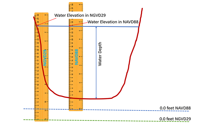
Water elevations are reported as the height of the water surface compared to sea level.
Water depth on the other hand, is the height of the water surface as measured from the bottom of the water body.
When NAVD 88 is fully implemented, water level readings will be published exclusively in NAVD 88.
FAQ’s – Upgrading from NGVD29 to NAVD88
Fact Sheet – Improving Accuracy of Water Level Data
Sign-up for updates below.