Land Management (Stewardship)
Why Land is Important for Water
There's a natural connection in Florida between water and land. Land catches and absorbs rainfall, holding it in lakes, ponds, streams and wetlands. While on land, water has time to slowly seep into groundwater aquifers, replenishing our drinking water supply.
Land for Conservation and Restoration
As the South Florida Water Management District's responsibilities have broadened over the decades to include ecosystem restoration, lands were purchased for their hydrologic benefits. Programs such as the 1981 Florida Resource Rivers Act, commonly known as "Save Our Rivers," provided state funding for environmentally sensitive lands to be acquired, restored, protected and managed. Caring for the land requires an ongoing commitment to protect water resources, native plant communities, fish and wildlife populations and natural features of the land. We work with the private sector and other resource agencies as we dovetail our efforts for the public's benefit.
Public Use and Ongoing Activities
Providing public access to public lands is mandated by the state and boldly embraced by the District. We cooperate with other state agencies, the federal government, counties, municipalities and the private sector to develop recreational access sites and appropriate facilities that are compatible with protecting our natural resources.
Related Links
Conservation Land Maps
Managing Land and Monitoring Resources
Managing more than 1 million acres of public lands is an important responsibility for the South Florida Water Management District. A large number of these conservation lands are open to the public for recreation and nearly all these lands require some form of stewardship activity. The District relies on other agencies and the private sector to help manage some of these lands. Cooperative agreements set forth the type and extent of management assistance provided. Where cooperating entities, such as the Florida Fish and Wildlife Conservation Commission or the Florida Forest Service, have their own rules for a tract of land, the District's regulations supplement those.
Click the tabs below to learn more about management activities on SFWMD lands.
- Natural Resources Monitoring
- Exotic Plant Control
- Prescribed Burning
- Range Management
- Resource Protection
- General Maintenance
Natural Resources Monitoring
Why Do We Monitor Land?
The South Florida Water Management District monitors its land resources to determine the most effective practices for managing land for environmental purposes and to document the results of management activities.
Active land management of natural areas is required in two situations, both of which require ongoing monitoring and evaluation:
- Land designated for conservation that has been modified by human activity but will be restored to natural conditions
- Land already in its natural condition that must be maintained
Restoration is the most challenging kind of land management. It requires a range of actions, such as blocking or filling of drainage ditches, treatment of large stands of invasive exotic plants with herbicide, selective harvesting of timber and intense or frequent prescribed fire. Restoration projects typically call for frequent monitoring because the ecosystem responds so dramatically to restoration actions.
How Do We Monitor?
Native vegetation is monitored on SFWMD conservation lands because it is not only valuable in itself but critical in determining habitat value for wildlife. Plants are easier to see and count than animals, but more than 500 species of plants grow on District lands. Trained botanists are essential to this work.
Supporting populations of native wildlife is one of the most important environmental purposes of District conservation lands. Each kind of animal requires a different approach to monitoring. Large birds and deer can be spotted from aircraft. Nesting songbirds are best located by their territorial calls. Nocturnal and secretive species such as Florida panthers can be detected by their tracks or droppings or by motion-capture cameras with flashes. Burrowing species such as gopher tortoises and sand skinks can be monitored by counting burrows or tell-tale marks left when they move through the sand. The elusive, nocturnal Florida muskrat makes nests of grasses and reeds that can be located by wading around in wetlands. The SFWMD relies heavily on experienced wildlife biologists from the Florida Fish and Wildlife Conservation Commission for monitoring animal populations.
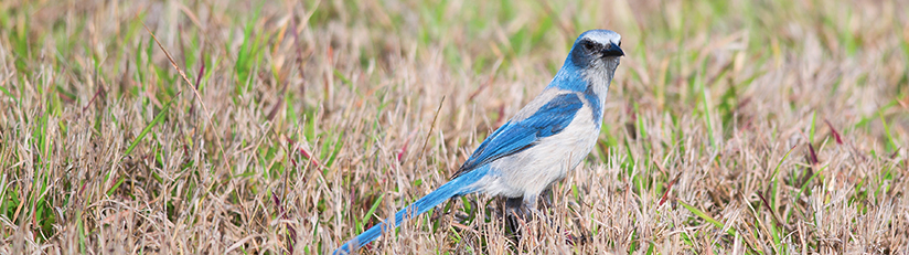
Photography is an efficient way to document the condition of a natural habitat. Although a photograph rarely allows identification of all plant species, it does instantly record a great deal of information about the sizes and spacing of trees, the density of shrub understory and the presence of grasses or herbaceous plants as a ground cover. These aspects of vegetation are what ecologists call habitat "structure" ̵ a very important part of what makes habitat suitable for particular wildlife. For example, scrub jays require shrubbery with open sandy areas and no large trees, while red cockaded woodpeckers demand large, well-spaced pines with little or no shrub layer. Effective land management has a lot to do with maintaining desirable habitat structure for native wildlife. A series of annual photographs tells the story of land that is basically unchanging, land gradually improving in structure or land that is moving away from ideal condition. This information helps the manager to adjust actions to meet wildlife goals. Comparing panoramas from different seasons is also a good way to get a feel for changes in habitat structure.
Exotic Plant Control
Due to the extensive alteration of natural ecosystems and a subtropical climate that favors their growth, exotic plants have become well-established in the environments of South Florida. Invasion of natural communities by exotic plants on SFWMD properties can result in total displacement of native plants, loss of wildlife habitat, alteration of local hydrology, changes in natural fire conditions and degradation of public use areas. Exotic plant control consists of proper application of various environmentally acceptable chemical herbicides combined with biological controls and mechanical techniques.
Prescribed Burning
Fire management is part of an integrated stewardship program for restoring and maintaining the natural state and condition of SFWMD-owned and managed ecologically significant areas. Most native plant communities in Florida are fire-adapted thanks to the historically high rate of lightning-induced fires. Prescribed burns during the heaviest growing season are favored because of their historic significance and ecological benefits. Restoration of a natural fire regime to reduce the frequency of dangerous wildfires is a major goal of the fire management program.
Because prescribed fire is such an important tool for managing conservation lands in Florida, fire gets special monitoring attention. Each fire is evaluated with respect to how fast it spreads, size of flames, degree of charring of tree trunks and scorching of canopy, burning of litter and upper soil layers and consumption of shrubs and palm fronds. Weeks after a fire, the recovering forest is evaluated for mortality of trees and shrubs and for boring insect infestations of injured or stressed trees. Information from fire monitoring is used by land managers to make decisions about how much fuel will be allowed to accumulate and what weather conditions will be appropriate before the next fire is planned.
Range Management
Many of the lands acquired by the South Florida Water Management District have historically been used as cattle range. Previous owners are provided the opportunity to retain grazing rights through leasebacks and reservations for a pre-determined period. Grazing leases are being established through a private/public partnership on selected projects where sufficient rangeland is available and where the presence of cattle does not interfere with or negatively affect other resource management goals. These leases strive to encourage management partners to provide maintenance services (e.g. fencing, mowing, roller chopping, exotic plant control) in lieu of payment. Leases generally run for a period of five years, placing rangeland back on the county tax rolls during that time. In addition, leases reduce District management costs by encouraging in-kind services in lieu of lease payments.
Resource Protection
The resource protection program utilizes a multi-faceted, multi-agency approach to protect the public and the vital natural resources found on and within the public lands and resource management areas. As part of the program, the SFWMD has adopted rules that govern public use on these District lands.
An array of contractual and non-contractual arrangements are entered into by the SFWMD wherein law enforcement officers from county sheriff's offices, the Florida Fish and Wildlife Conservation Commission and the Florida Department of Environmental Protection patrol public lands, including those acquired under Save Our Rivers to enforce federal and state laws and administrative code. Common problems encountered by these law enforcement officers, associated with the protection of natural areas, include: hunting, fishing and boating violations; dumping of wastes; unauthorized off-road vehicle operation; and trespassing onto adjacent private properties.
Report a Problem
Problems or violations occurring on these public properties may be reported to the South Florida Water Management District by calling (800) 432-2045.
To report wildlife violations, contact the Florida Fish and Wildlife Conservation Commission:
- Statewide: (888) 404-FWCC [3922]
- From a cell phone: dial *FWC
In case of emergencies, contact your local sheriff's office at: 911
General Maintenance
General maintenance is required for the large number of fire lines, roads, fences, culverts, houses and sheds associated with South Florida Water Management District lands. These activities include waste cleanup, building fire lines, repairing and replacing perimeter fences, mowing roadsides, replacing and repairing culverts and grading roads. Houses, barns, sheds and public use facilities also require periodic maintenance and repair for safe and enjoyable use by the public.