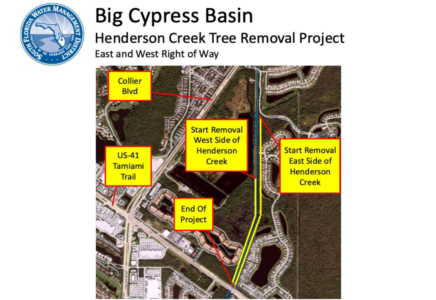
Flood Protection Around Henderson Creek Canal
 To ensure the Henderson Creek Canal can continue to provide adequate flood protection for residents in Collier County, the Big Cypress Basin (Basin) is conducting a vegetation removal effort. The project will began in June 2024 and will be completed July/August 2024.
To access and maintain the canal banks to provide optimal flood protection, the Basin has right-of-way easements along the canal situated on private property. With the assistance of contractors, vegetation within the easements between Winding Cypress Blvd and the US-41, Tamiami Trail will be removed.
Below legal surveys are posted in the "Removal Areas and Schedule" section below so property owners living along the canal can identify the relationship of the District's easements to their property.
Any improvements within the canal, on the canal bank or within the easement will require a Right of Way Occupancy Permit. Information on the requirements for obtaining a permit can be found at SFWMD.gov/RowPermits.
This removal work is part of a normal cycle of maintenance to ensure that regional canals protect homes and business from flooding and that the canals function optimally during a storm, such as Hurricane Irma in September 2017. Trees along a canal right of way may end up in the canal and cause blockages around downstream water control structures. In turn, these obstructions can prevent water from properly draining and could result in flooding that endangers the safety of residents in the immediate area and many miles away.
Removal Areas and Schedule
All impacted residents will be notified 30 days prior to the start date and again two weeks prior to the commencement of work in a specific area.