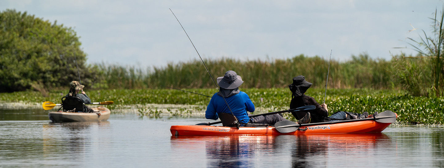
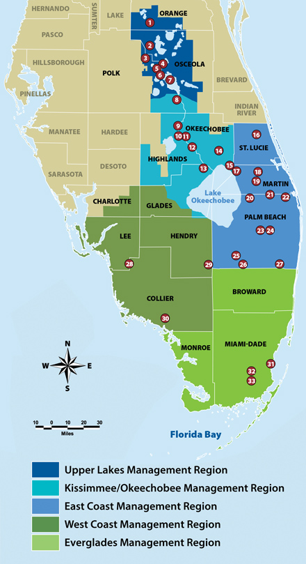
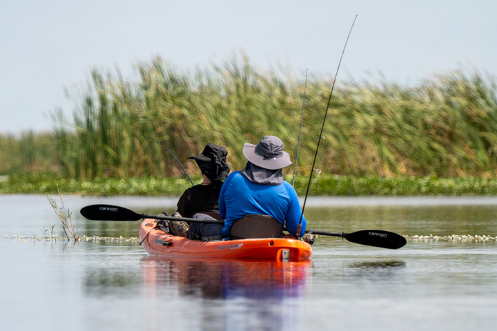
ASK US
Search site
Search
South Florida Water Management District
Toggle navigation
Who We Are
Governing Board Chairman
Open Government
Governing Board
Budget & Finance Reports
Careers
Contact Us
Our Work
Flood Control
Water Supply Planning
Water Quality Improvement
Ecosystem Restoration
Python Elimination Program
Addressing Blue-Green Algae
Resiliency
Doing Business with Us
Permits
RegPermitting
ePermitting
Right of Way Permits
Procurement
Real Estate
Grants/Funding Opportunities
Community & Residents
Water Conservation
Recreation
Navigation
Education Center
Everglades License Plate
Science & Data
Real-Time Data
Vertical Datum Upgrade
Scientific Publications & SFER
DBHYDRO
Weather
Operational Planning
GIS
Survey Data
Modeling
News & Meetings
News Releases
Public Meetings
Calendar
Speakers Bureau
Photo & Video
Fact Sheets
Contact Us
Careers
Locations
Home
water conservation area 1 arthur r marshall loxahatchee national wildlife refuge 0
Recreation Sites
Activities
Operator
Is one of
Is all of
Is none of
Is empty (NULL)
Is not empty (NOT NULL)
Airboating
Boardwalk
Fishing Pier
Hunting
Hunting
Parking
Pets Allowed
Photography
Restrooms
Signage/Kiosk
Bicycling
Bird-Watching
Boat Ramps
Boating
Butterfly Garden
Camping (Equestrian)
Camping (Group)
Camping (RV/Travel Trailer)
Camping (Tent)
Canoeing
Education Center
Equestrian Trails
Fishing
Frogging
Geocaching
Hiking
Hunting
Kayaking
Picnicking
Shelter/Pavilion
Stargazing
Swimming
Visitors Center
Wildflower Viewing
Wildlife Viewing
Lookup a Site
Lookup a Site
4E’s
(
#11
)
A-1 Flow Equalization Basin
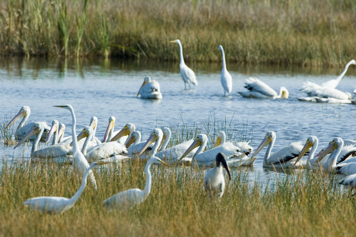
(
#25
)
Allapattah Flats
(
#18
)
Arthur R. Marshall Loxahatchee National Wildlife Refuge
(
#29
)
Atlantic Ridge Preserve State Park
(
#17
)
Baker Dairy
(
#4
)
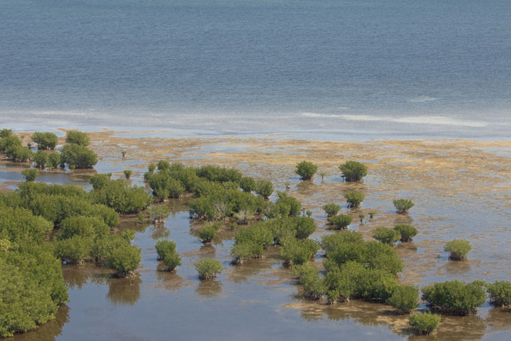
Biscayne Bay Coastal Wetlands
(
#31
)
Blanket Bay Slough
(
#8
)
Blind Creek
(
#13
)
Bluff Hammock
(
#9
)
Boney Marsh
(
#9
)
C-44 Stormwater Treatment Area
(
#19
)
Catfish Creek
(
#6
)
Chandler Slough
(
#12
)
Corkscrew Regional Ecosystem Watershed (CREW)
(
#28
)
Cornwell Marsh
(
#11
)
Cypress Lake
(
#4
)
Drasdo
(
#6
)
DuPuis Management Area
(
#20
)
East Shore
(
#7
)
Everglades & Francis S. Taylor Wildlife Management Area
(
#27
)
Fort Basinger
(
#11
)
Fran Reich Preserve
(
#27
)
Frog Pond
(
#32
)
Gardner-Cobb
(
#4
)
Gordy Road Recreation Area
(
#14
)
Grassy Island
(
#14
)
Green Heart of the Everglades Public Small Game Hunting Area
(
#30
)
Halpatiokee Regional Park
(
#17
)
Harold A. Campbell Public Small Game Hunting Area
(
#26
)
Hickory Hammock
(
#10
)
Horse Creek
(
#4
)
Huckleberry Island
(
#4
)
Hungryland Wildlife and Environmental Area
(
#21
)
Intercession City
(
#3
)
Istokpoga Canal Boat Ramp Area
(
#10
)
Johnson Island
(
#5
)
KICCO
(
#8
)
Kissimmee Prairie Preserve State Park
(
#12
)
Lake Hatchineha and C-37
(
#6
)
Lake Kissimmee Islands
(
#7
)
Lake Kissimmee: Bird Island
(
#7
)
Lake Kissimmee: Drasdo
(
#7
)
Lake Kissimmee: Eastshore and Westshore
(
#7
)
Lake Kissimmee: Gardner-Cobb Marsh
(
#7
)
Lake Kissimmee: Lightsey
(
#7
)
Lake Kissimmee: Rabbit Island
(
#7
)
Lake Kissimmee: Strum Island
(
#7
)
Lake Marion Creek
(
#4
)
Lake Russell
(
#3
)
Lakeside Ranch
(
#17
)
Lower Reedy Creek
(
#6
)
Loxahatchee River/Cypress Creek Management Area
(
#22
)
Loxahatchee Slough Natural Area
(
#20
)
MICCO Landing
(
#11
)
Miller/Wild Property
(
#13
)
No Name Slough
(
#9
)
North Fork St. Lucie River
(
#15
)
Nubbin Slough Stormwater Treatment Area
(
#15
)
Oak Creek
(
#9
)
Okaloacoochee Slough Wildlife Management Area
(
#25
)
Pal-Mar East/Nine Gems
(
#20
)
Paradise Run
(
#13
)
Queen's Island
(
#13
)
Reedy Creek
(
#3
)
Riverbend Park
(
#21
)
Rocky Glades
(
#32
)
Rolling Meadows
(
#6
)
Rough Island
(
#5
)
S-65D Boat Ramp
(
#12
)
S-65E Impoundment
(
#13
)
Seaboard
(
#12
)
Shingle Creek
(
#1
)
Six Mile Cypress Slough Preserve
(
#24
)
Snell Creek
(
#4
)
Southern Glades
(
#33
)
Spruce Bluff
(
#15
)
Starvation Slough
(
#9
)
Stormwater Treatment Area 1 East
(
#24
)
Stormwater Treatment Area 1 West
(
#23
)
Stormwater Treatment Area 3/4
(
#26
)
Stormwater Treatment Area 5/6
(
#23
)
SUMICA
(
#10
)
Taylor Creek
(
#14
)
Telex
(
#12
)
Ten Mile Creek
(
#16
)
Three Scrub Sites
(
#15
)
Tibet-Butler Preserve
(
#1
)
Torrelli South
(
#4
)
Turkey Hammock
(
#11
)
Upper Reedy Creek
(
#3
)
Water Conservation Area 1
(
#29
)
Water Conservation Areas 2 and 3
(
#27
)
West Shore
(
#7
)
Yates Marsh
(
#12
)
Find Sites
Matching Sites:
4E’s (#11)
4E’s
Take in the beauty of picturesque flowering marsh plants. Pink marsh mallow “hibiscus,” purple…
Allapattah Flats (#18)
Allapattah Flats
Featuring an expanse of predominately wet flatwoods that has mostly been converted to improved…
Atlantic Ridge Preserve State Park (#17)
Atlantic Ridge Preserve State Park
Take yourself back in time on a hike along the South Fork St. Lucie River. Take care as you…
Blanket Bay Slough (#8)
Blanket Bay Slough
Blanket Bay Slough offers primitive waterfront camping on the east side of the Kissimmee River.…
Boney Marsh (#9)
Boney Marsh
Located along the eastern edge of the Kissimmee River floodplain, Oak Creek has many old-growth…
Catfish Creek (#6)
Catfish Creek
Nestled on the shores of Lake Hatchineha, this area offers many recreational opportunities and…
Chandler Slough (#12)
Chandler Slough
Chandler Slough is a beautiful tract of cypress swamp, oak and cabbage palm hammocks and marsh…
Corkscrew Regional Ecosystem Watershed (CREW) (#28)
Corkscrew Regional Ecosystem Watershed (CREW)
The Corkscrew Regional Ecosystem Watershed (CREW), located in Lee and Collier counties, provides…
Drasdo (#6)
Drasdo
Nestled on the shores of Lake Hatchineha, this area offers many recreational opportunities and…
DuPuis Management Area (#20)
DuPuis Management Area
Notifications Posted July 24, 2024: A portion of the Powerline Grade in the Dupuis Management…
East Shore (#7)
East Shore
Lake Kissimmee collects water from the upper lakes region, which flows south to the Kissimmee River…
Gardner-Cobb (#4)
Gardner-Cobb
The Gardner-Cobb Marsh is located in the Kissimmee Chain of Lakes watershed between Cypress Lake,…
Halpatiokee Regional Park (#17)
Halpatiokee Regional Park
Take yourself back in time on a hike along the South Fork St. Lucie River. Take care as you…
Hickory Hammock (#10)
Hickory Hammock
Majestic live oaks line both sides of the hiking trail as you enter Hickory Hammock. Marshes,…
Huckleberry Island (#4)
Huckleberry Island
Huckleberry Island is part of the Lake Marion Creek Wildlife Management Area which also includes…
Hungryland Wildlife and Environmental Area (#21)
Hungryland Wildlife and Environmental Area
Outdoor enthusiasts can take advantage of several miles of established, multi-use trails for hiking…
Istokpoga Canal Boat Ramp Area (#10)
Istokpoga Canal Boat Ramp Area
The Istokpoga Canal Boat Ramp Area features boat ramps and an airboat ramp. It also has access to…
Johnson Island (#5)
Johnson Island
Located in the Reedy Creek watershed, this area features picturesque views amid a mosaic of…
KICCO (#8)
KICCO
KICCO Wildlife Management Area, which is pronounced kiss-oh, is a place where you can get the real…
Kissimmee Prairie Preserve State Park (#12)
Kissimmee Prairie Preserve State Park
This remote and sweeping preserve is reminiscent of western prairies. But here, cabbage palms dot…
Lake Hatchineha and C-37 (#6)
Lake Hatchineha and C-37
The area surrounding Lake Hatchineha offers many recreational opportunities and beautiful vistas.…
Lake Kissimmee: Drasdo (#7)
Lake Kissimmee: Drasdo
Accessible only by boat or airboat, Gardner-Cobb Marsh is the largest District property in the…
Lake Kissimmee: Gardner-Cobb Marsh (#7)
Lake Kissimmee: Gardner-Cobb Marsh
Accessible only by boat or airboat, Gardner-Cobb Marsh is the largest District property in the…
Lake Kissimmee: Lightsey (#7)
Lake Kissimmee: Lightsey
Accessible only by boat or airboat, Gardner-Cobb Marsh is the largest District property in the…
Lower Reedy Creek (#6)
Lower Reedy Creek
Reedy Creek watershed is one of the most diverse and intact watercourses in the area. While…
Loxahatchee River/Cypress Creek Management Area (#22)
Loxahatchee River/Cypress Creek Management Area
South Florida’s first federally designated Wild and Scenic River, the seven-mile Northwest Fork of…
MICCO Landing (#11)
MICCO Landing
Take in the beauty of picturesque flowering marsh plants. Pink marsh mallow “hibiscus,” purple…
No Name Slough (#9)
No Name Slough
Located along the eastern edge of the Kissimmee River floodplain, the Starvation Slough Airboat…
Oak Creek (#9)
Oak Creek
Located along the eastern edge of the Kissimmee River floodplain, Oak Creek has many old-growth…
Okaloacoochee Slough Wildlife Management Area (#25)
Okaloacoochee Slough Wildlife Management Area
The over 35,000-acre Okaloacoochee Slough Wildlife Management Area in Hendry County provides…
Paradise Run (#13)
Paradise Run
At the end of the old Kissimmee River, on the north side of S-65E, you’ll find an expanse of thick…
Rough Island (#5)
Rough Island
Located in the Reedy Creek watershed, this area features picturesque views amid a mosaic of…
S-65E Impoundment (#13)
S-65E Impoundment
At the end of the old Kissimmee River, on the north side of S-65E, you’ll find an expanse of thick…
Seaboard (#12)
Seaboard
Chandler Slough is a beautiful tract of cypress swamp, oak and cabbage palm hammocks and marsh…
Starvation Slough (#9)
Starvation Slough
Located along the eastern edge of the Kissimmee River floodplain, the Starvation Slough Airboat…
SUMICA (#10)
SUMICA
SUMICA, once slated for watermelon farming, is the site of a former logging community and sawmill.…
West Shore (#7)
West Shore
Lake Kissimmee collects water from the upper lakes region, which flows south to the Kissimmee River…
Yates Marsh (#12)
Yates Marsh
Chandler Slough is a beautiful tract of cypress swamp, oak and cabbage palm hammocks and marsh…
Site Locations: