  • Facebook
  • Instagram
  • Twitter
  • Linkedin
  • Youtube
  • ASK US
Home South Florida Water Management District
  • Who We Are
    • Governing Board Chairman
    • Open Government
    • Governing Board
    • Budget & Finance Reports
    • Careers
    • Locations
    • Contact Us
  • Our Work
    • Flood Control
    • Water Supply Planning
    • Water Quality Improvement
    • Ecosystem Restoration
    • Python Elimination Program
    • Addressing Blue-Green Algae
    • Resiliency
  • Doing Business with Us
    • Permits
    • RegPermitting
    • ePermitting
    • Right of Way Permits
    • Procurement
    • Real Estate
    • Grants/Funding Opportunities
  • Community & Residents
    • Water Conservation
    • Recreation
    • Navigation
    • Education Center
    • Everglades License Plate
  • Science & Data
    • Real-Time Data
    • Vertical Datum Upgrade
    • Scientific Publications & SFER
    • DBHYDRO
    • Weather
    • Operational Planning
    • GIS
    • Survey Data
    • Modeling
  • News & Meetings
    • News Releases
    • Public Meetings
    • Calendar
    • Speakers Bureau
    • Media, Photo & Video
    • Fact Sheets
  • Contact Us
  • Careers
  • Locations
  1. Home
  2. news
  3. nr 2018 0906 gis open data portal
  • News Releases
  • News Archive (Oct. 2009 - July 2020)
  • Fact Sheets
  • Calendar
  • Speakers Bureau
  • Media, Photo & Video
  • Public Meetings and Forums
SFWMD Unveils New Public Geospatial Data Website
screenshot of GIS Open Data Portal

Sept. 6, 2018

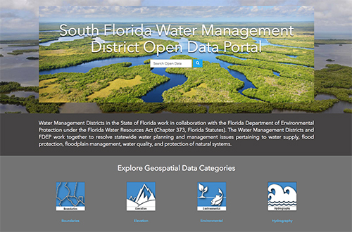
West Palm Beach, FL – The South Florida Water Management District (SFWMD) this week unveiled a new web page to provide the public with easy access to its geospatial/GIS datasets. The public can browse, search, filter, preview and download the GIS datasets in a variety of formats.

The South Florida Water Management District Open Data Portal website offers GIS datasets in many different categories from environmental to hydrography to land resources to permits to regulatory datasets. These datasets are maintained by SFWMD and are used by water managers to make operational decisions for the agency's critical missions.

Data available for public viewing include maps of watershed and basin boundaries, sites of District facilities, water utility service boundaries and maps of vegetation in the Kissimmee River floodplain dating back to 1952.

"This Governing Board wants the public to have as much access to the data that goes into water management decisions as possible, so they can understand and play a valuable role in the process," said SFWMD Governing Board Chairman Federico Fernandez. "This new geospatial website puts crucial data just a click away for the 8.1 million residents we serve."

more »

  • ASK US
  • Who We Are
    • Governing Board
    • Big Cypress Basin Board
    • Open Government
    • Public Records Request
  • Our Work
    • Flood Control
    • Resiliency
    • Emergency Management
    • Water Supply Planning
    • Water Quality Improvement
    • Ecosystem Restoration
    • Land Management
  • Community and Residents
    • Water Conservation
    • Year-Round Rule
    • Recreation
    • Educational Center
    • Volunteering
  • Doing Business with Us
    • Permits
    • RegPermitting
    • ePermitting
    • Right of Way Permits
    • Procurement
    • Real Estate
    • Grants/Funding
    • Agriculture
    • AVATAR
  • Science and Information/Data
    • Real-Time Data
    • Water Levels
    • Scientific Publications & SFER
    • DBHYDRO
    • Weather
    • Operational Planning
    • Environmental Monitoring
    • Modeling
  • News and Events
    • News Releases
    • Meeting Agendas & Minutes
    • Calendar
    • Photo and Video Resources
South Florida Water Management District

Contact Information

3301 Gun Club Road
West Palm Beach, FL 33406

561-686-8800

800-432-2045 (Florida Only)

  • Facebook
  • Instagram
  • Twitter
  • Linkedin
  • Youtube
  • ASK US
  • Privacy Policy
  • Disclaimer
  • Accessibility
  • Contact Us
  • Locations
  • Careers