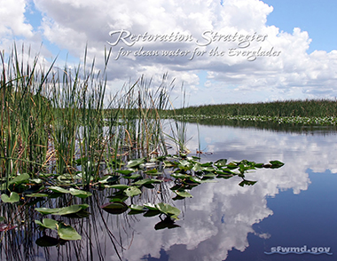
Restoration Strategies for Clean Water for the Everglades
 The State of Florida and the U.S. Environmental Protection Agency reached a consensus on new strategies for improving water quality in America's Everglades. Based on months of scientific and technical discussions, these strategies will expand water quality improvement projects to achieve the phosphorus water quality standard established for the Everglades.
Under these strategies, the South Florida Water Management District is implementing a technical plan to complete several projects that will create more than 6,500 acres of new stormwater treatment areas (STAs) and 116,000 acre-feet of additional water storage through construction of flow equalization basins (FEBs). Flow equalization basins provide a more steady flow of water to the STAs, helping to maintain desired water levels needed to achieve optimal water quality treatment performance.
A flow equalization basin (FEB) is a constructed storage feature used to capture and store peak stormwater flows. Water managers can move water from FEBs into STAs at a steady rate to optimize STA performance and achieve water quality improvement targets.
The strategies also include additional source controls – where pollution is reduced at the source – in areas of the eastern Everglades Agricultural Area where phosphorus levels in stormwater runoff have been historically higher. In addition, a robust science plan will ensure continued research and monitoring to improve and optimize the performance of water quality treatment technologies.
Related Links
- DEP: STA Watershed Permits and Supporting Documentation
- Restoration Strategies Regional Water Quality Plan [PDF]
- Restoration Strategies Science Plan
- Quick Facts on Restoration Strategies for Clean Water for the Everglades [PDF]
- Site Status Report – Real-time water levels, flows and more
- STA Operations Report – Real-time water levels and flows for STAs and FEBs
Current Projects
Construction of the treatment, storage and conveyance improvement projects in the Restoration Strategies Regional Water Quality Plan will be complete by 2025. Several projects are already operational, and many others are underway.
- STA-1 West Expansion
- A-1 FEB
- L-8 FEB
- L-8 Divide Structure
- S-5AS Modifications
- S-375 Expansion
- G-341 Conveyance
Stormwater Treatment Area 1 West Expansion
Located immediately northwest of the Arthur R. Marshall Loxahatchee National Wildlife Refuge, STA-1 West removes excess phosphorus and other nutrients from stormwater flowing into the Refuge and other parts of the greater Everglades. The 6,500-acre expansion of STA-1 West, which will take place in two phases, will double its effective treatment area and further reduce phosphorus concentrations.
Phase 1
- Project Status: Construction completed
- Construction Completion Date: January 2019
- FYI: Stormwater Treatment Area 1 West Expansion [PDF]
Phase 2
- Project Status: Land acquisition completed January 2018; design scheduled to start by October 2018
- Expected Construction Completion Date: December 2022
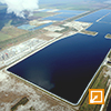
A-1 Flow Equalization Basin
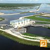
With a capacity of 60,000 acre-feet, this project is the largest of three flow equalization basins in the Restoration Strategies plan. The A-1 FEB attenuates peak stormwater flows, temporarily storing water so it can be delivered at a steady rate to STA-2 and STA-3/4 to improve their performance. As a shallow FEB, the A-1 also contains emergent vegetation to help reduce phosphorus concentrations before moving water to the STAs.
- Project Status: Operational
- Construction Completion Date: July 2015
- FYI: A-1 Flow Equalization Basin [PDF]
{"preview_thumbnail":"/sites/default/files/styles/video_embed_wysiwyg_preview/public/video_thumbnails/139473726.jpg?itok=Pd0n7NU6","video_url":"https://vimeo.com/139473726","settings":{"responsive":1,"width":"854","height":"480","autoplay":0},"settings_summary":["Embedded Video (Responsive)."]}
With construction complete, water began flowing into the A‑1 Flow Equalization Basin for the first time in August 2015.
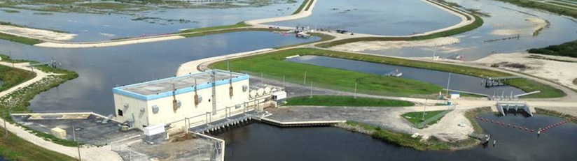
L-8 Flow Equalization Basin
Building on a strategically located 950-acre former rock mine, this deep below-ground reservoir is capable of storing 45,000 acre-feet of water. Initially, this project will function as a multipurpose FEB to capture, store and deliver stormwater to STA-1 East and STA-1 West to improve their performance and to provide interim benefits for restoration purposes. When the STA-1 West expansion is operational, the L-8 FEB will transition to primarily storing stormwater runoff and delivering flows to optimize the treatment performance of STA-1 East and STA-1 West.
- Project Status: Operational
- Construction Completion Date: July 2017
- FYI: L-8 Flow Equalization Basin [PDF]
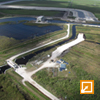
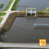
L-8 Divide Structure (G-541)

G-541 is a fully automated water control structure located within the L-8 canal, just east of the L-8 FEB. The structure will assist the movement of water into the L-8 FEB for storage and, when needed, assist in directing FEB outflows south to STA-1 East and STA-1 West for treatment. G-541 is designed to function within the current operational criteria for the L-8 canal to maintain flood control for the basin.
- Project Status: Operational
- Construction Completion Date: July 2016
S-5AS Structure Modifications
Implementation of projects in the Restoration Strategies plan will increase the use of the existing S-5AS structure to direct stormwater runoff north to the L-8 FEB for storage. As a result, some modifications and upgrades to the structure are required to ensure more efficient operations.
- Project Status: Operational
- Construction Completion Date: May 2016
S-375 Structure Expansion (G-716)
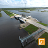
The new G-716 structure expands the capacity of the existing S-375 structure, located within STA-1 East. During high flow events in the C-51 West Basin or when STA-1 East is already receiving optimal flows, S-375 and G-716 will direct stormwater runoff to the L-8 FEB for storage prior to being redirected to STA-1 East and/or STA-1 West for treatment.
- Project Status: Operational
- Construction Completion Date: April 2017
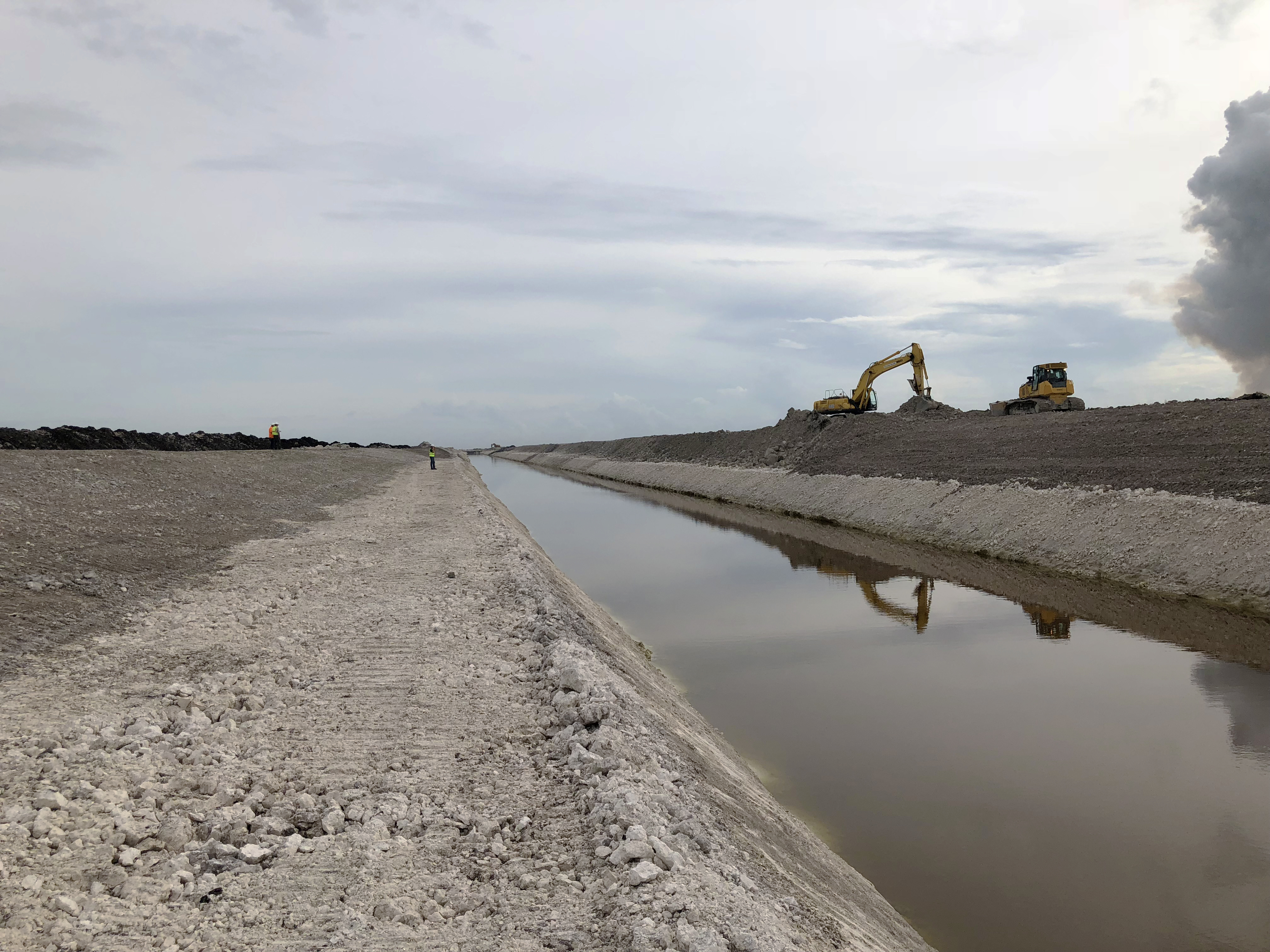
G-341 Related Conveyance Improvements
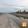
The G-341 Related Conveyance Improvements project is a multi-phase, multi-year project intended to improve conveyance within the eastern Everglades Agricultural Area, specifically in the Bolles East, Ocean and Hillsboro canals.
- Project Status: Improvements to Bolles East Canal Segments 1 and 2 are complete; Segment 3 construction and Segment 4 design are ongoing; preliminary agreements reached for replacement of remaining Bolles East Canal bridges
- Construction Completion Date: December 2024
What is phosphorus?
Although it is a vital nutrient in all natural systems, phosphorus is also a fertilizer component. It flows across the landscape in stormwater runoff (urban and agriculture), harming natural areas by promoting algae growth and an overabundance of non-native plants, crowding out natural vegetation and disrupting food sources and habitats used by native wildlife. The Everglades is naturally a low-nutrient system. Even small amounts of additional nutrients can upset the ecological balance needed by the native plants and animals in the historic "River of Grass."
Source Controls
The objective of Restoration Strategies subregional source control projects is to build upon the success of the District's existing Works of the District Best Management Practices (BMPs) Program by focusing on projects with the greatest potential to further improve water quality in the eastern Everglades Agricultural Area, specifically in the S-5A basin, thereby reducing phosphorus loads to the STAs. Subregional source control projects within the S-5A basin are being considered based on a combination of factors, including water quality of their discharges, proximity and potential impact to the STAs, potential positive impact to the Arthur R. Marshall Loxahatchee National Wildlife Refuge (also known as Water Conservation Area 1) and having willing local participants.
A demonstration project within the East Beach Water Control District (EBWCD), located in the northwest portion of the S-5A basin, was implemented to build upon promising preliminary results of comprehensive canal management research conducted by the University of Florida. The project purpose was to evaluate the water quality of canals with both typical canal cleaning practices and more intensive canal cleaning practices.
Review of available pre- and post-project data indicates that it may be difficult to assess the canal cleaning project's water quality benefits. Factors confounding the evaluation include the effect of varying hydrologic conditions on phosphorus concentration and load and the need for a more robust baseline data set. Nevertheless, available data suggest a lesser incidence of particulate phosphorus peak concentrations after the more intensive canal cleaning practices began. A technical memorandum consolidating data with respect to water quality and flow trends from the EBWCD and recent canal cleaning project efforts was completed. Continued water quality monitoring together with long-term tracking of canal cleaning activities within EBWCD are necessary to capture the long-term water quality benefits of the project.
The consolidation of historical information is an essential element for project formulation and consultation with stakeholders. Accordingly, S-5A basin flow, phosphorus load and phosphorus concentration data were evaluated and documented in a technical memorandum. Data sets included the S-5A basin boundary structures and G-341 (the Ocean Canal divide structure), monitoring stations within the West Palm Beach Canal and permitted sub-basins discharging into the West Palm Beach and Ocean canals. Data sets were evaluated to quantify apparent trends and variation in the data, wet and dry seasons, pre- and post-BMP implementation and pre- and post-diversion of EBWCD discharges from Lake Okeechobee to the STAs. These analyses also evaluated the portion of dissolved and particulate phosphorus fractions in S-5A basin inflows, S-5A basin outflows and runoff generated within the S-5A basin.
The analyses indicate that phosphorus levels in S-5A basin runoff have improved historically and particulate phosphorus is the predominant fraction in Lake Okeechobee inflows to the S-5A basin, while dissolved phosphorus is higher in S-5A basin outflows. The analysis also shed light on phosphorus transport and cycling in the West Palm Beach Canal during different conditions, including Lake Okeechobee pass-through events. Findings document lower phosphorus concentrations in the southern portion of the West Palm Beach Canal, as compared to the northern portion of the canal.
Background
![]() The technical plan is part of a revised National Pollutant Discharge Elimination System (NPDES) permit issued by the Florida Department of Environmental Protection and approved by the U.S. Environmental Protection Agency for operation of the District's network of Stormwater Treatment Areas south of Lake Okeechobee. The NPDES permit – along with a new state-issued Everglades Forever Act permit – establishes stringent phosphorus limits for water discharged into the Everglades.
The technical plan is part of a revised National Pollutant Discharge Elimination System (NPDES) permit issued by the Florida Department of Environmental Protection and approved by the U.S. Environmental Protection Agency for operation of the District's network of Stormwater Treatment Areas south of Lake Okeechobee. The NPDES permit – along with a new state-issued Everglades Forever Act permit – establishes stringent phosphorus limits for water discharged into the Everglades.
Construction of new treatment and storage projects identified in the technical plan will build on the State's significant progress to protect the Everglades. To date, the State of Florida has invested more than $2.5 billion toward improving water quality in the "River of Grass."
Key water quality improvements to date include:
- Operation of five Everglades STAs with an effective treatment area of 57,000 acres. In Water Year 2017, these constructed wetlands treated more than 1.1 million acre-feet of water bound for the Everglades, reducing phosphorus loads by 84 percent.
- Implementation of improved farming methods, known as Best Management Practices (BMPs), on 470,000 acres of agricultural lands south of Lake Okeechobee. Over the BMP program's 20-year history in the Everglades Agricultural Area, the average phosphorus reduction is more than twice the amount required by Florida's Everglades Forever Act.
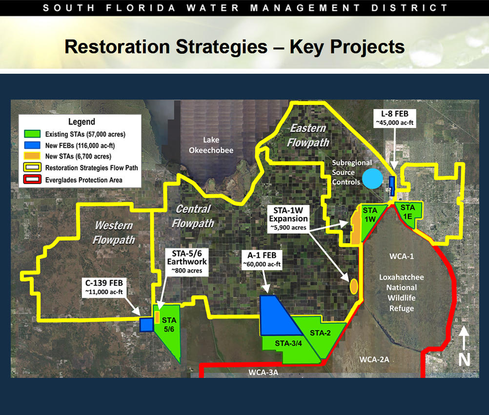
Photo: Stormwater Treatment Area 1 West Expansion
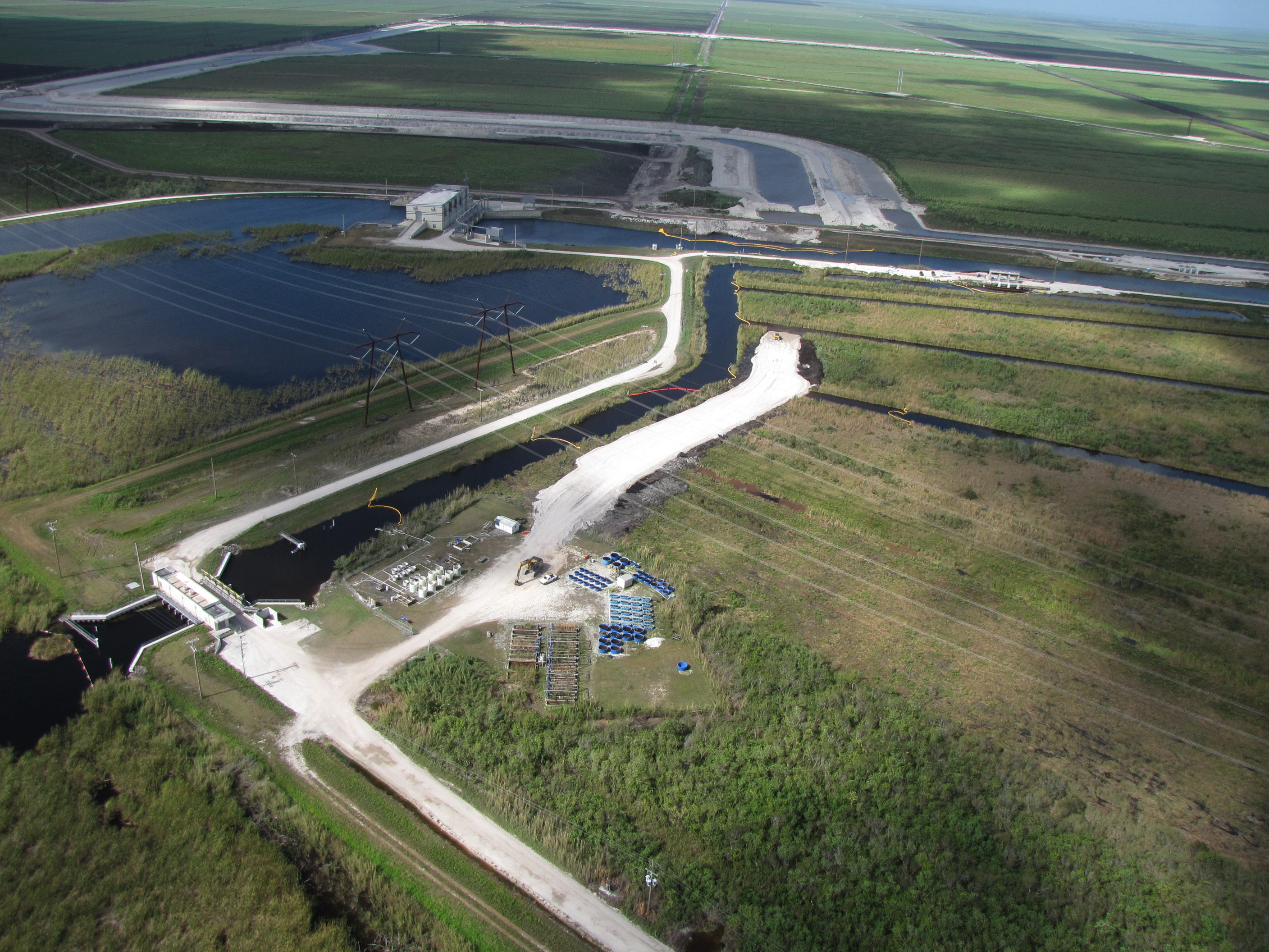
Photo: A-1 Flow Equalization Basin
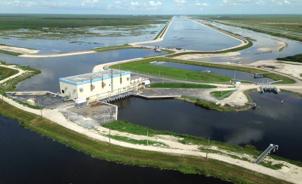
Photo: L-8 Flow Equalization Basin
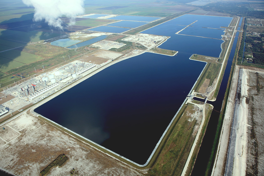
Photo: L-8 Divide Structure (G-541)
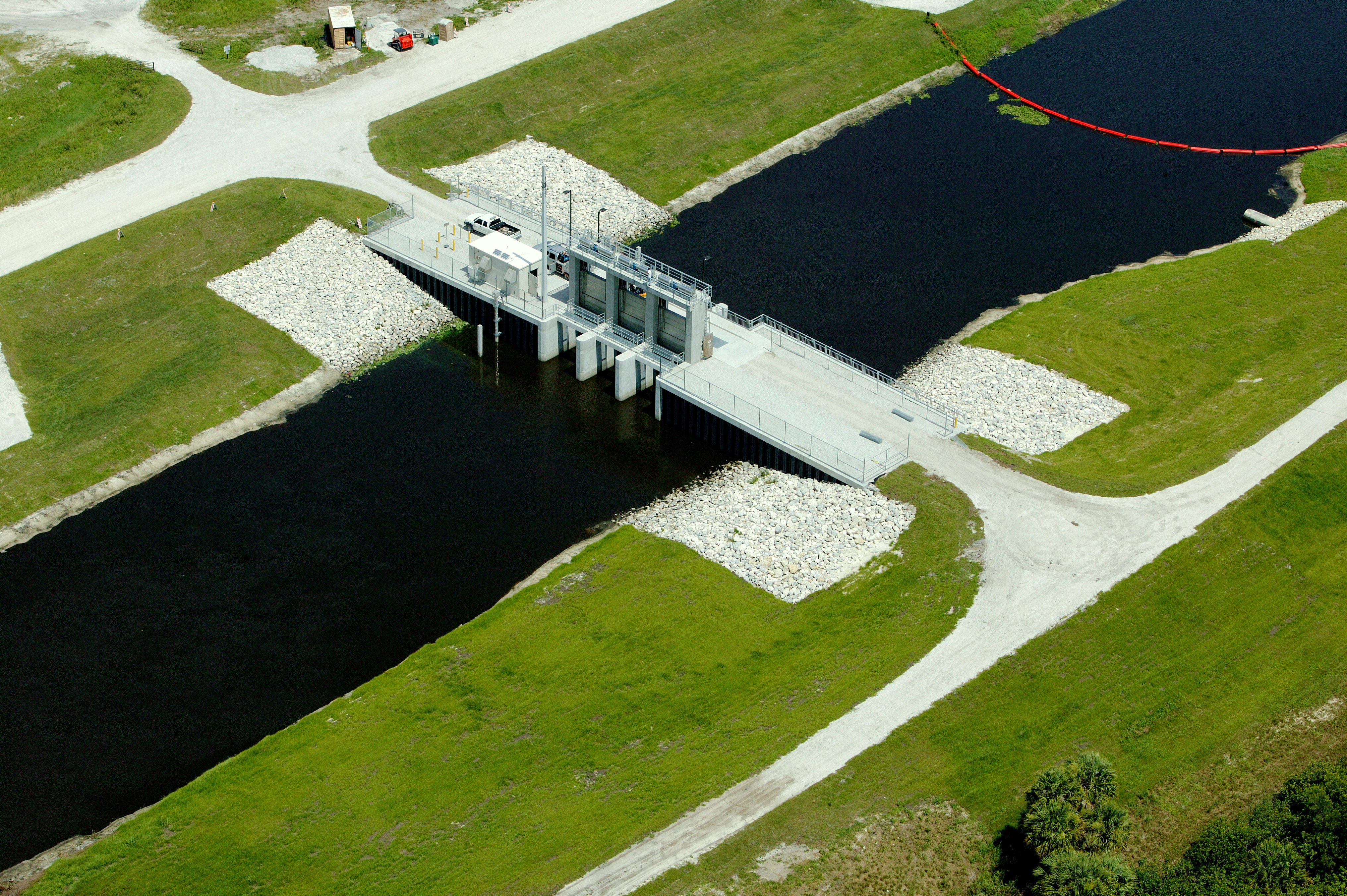
Photo: S-5AS Structure Modifications
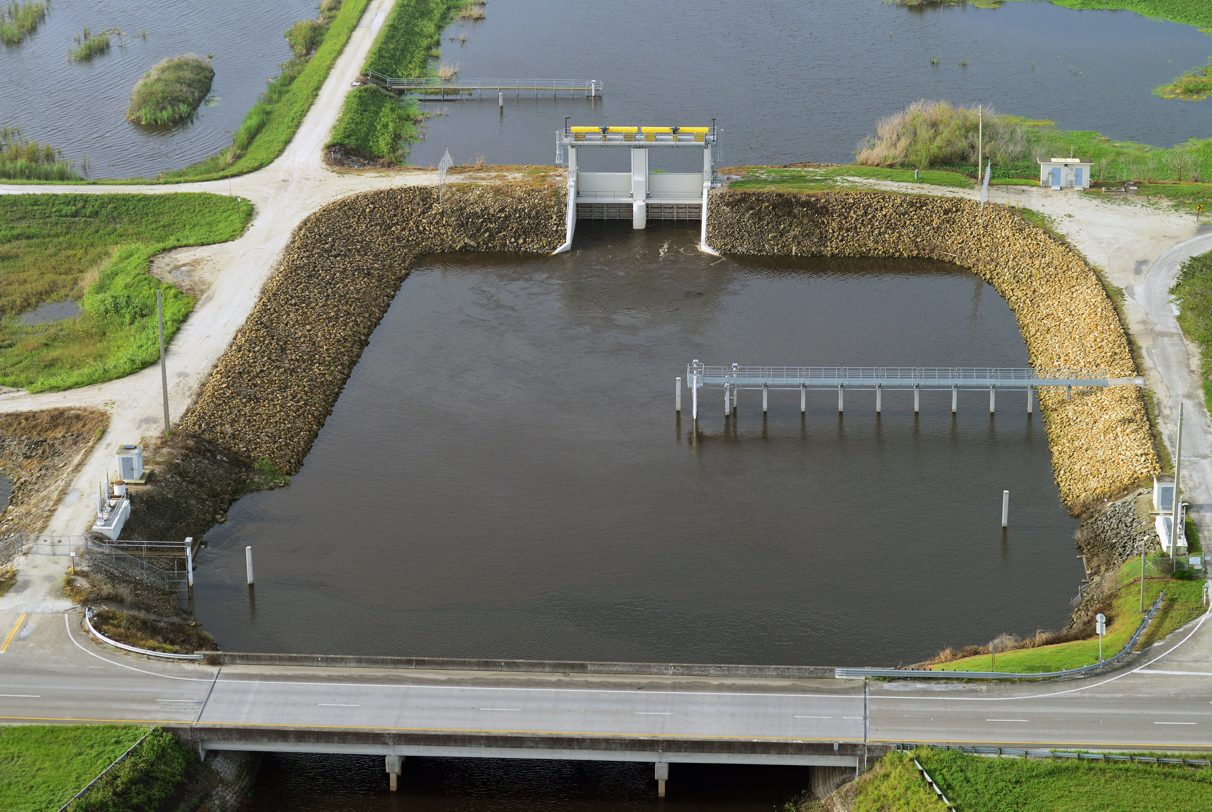
Photo: S-375 Structure Expansion (G-716)
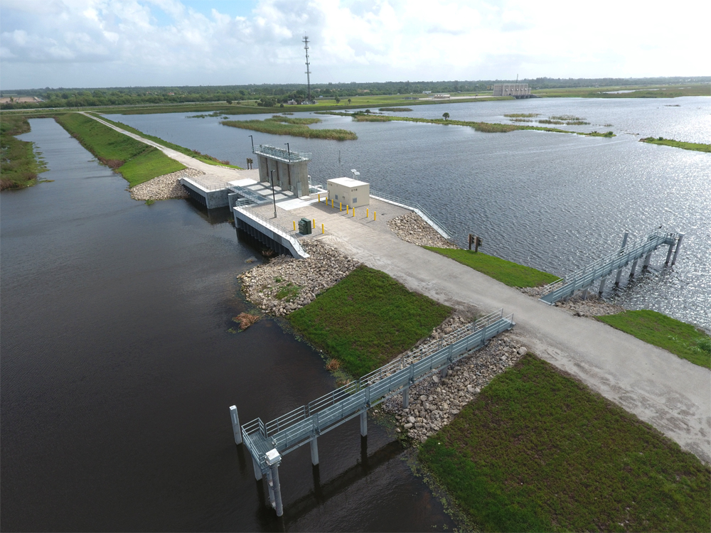
Photo: G-341 Related Conveyance Improvements
 Restoration Strategies Regional Water Quality Plan
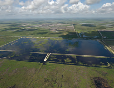 Restoration Strategies Science Plan